Idaho Bush Trip

Ici on peut se donner rendez-vous pour un vol en réseau :

- en multijoueur simplement
- sur IVAO ou VATSIM

Modérateur : frenchsimmer

Répondre
guitou1111
Pilote
Messages : 113
Enregistré le : sam. août 22, 2020 1:56 pm

Idaho Bush Trip

Message par guitou1111 »

Salut à tous,
Un bush trip trouvé sur le Forum Officiel MSFS qui me tente bien.
4 sessions pour faire les 15legs.
https://msfsbushtrips.com/idaho-bush-tr ... ator-2020/


Samedi aprèm pour le départ du Jour 1 14h30?
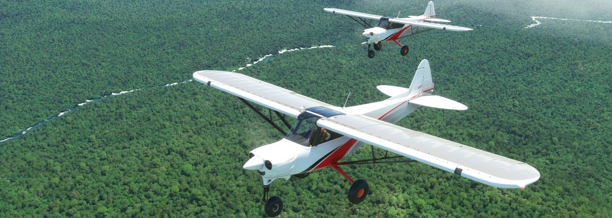
Avion: XCub
Météo: en groupe pour régler la météo comme indiqué à chaque leg.
Little Navmap Map 20200917-222736.jpg
Little Navmap Map 20200917-222736.jpg (511.1 Kio) Vu 9565 fois
VFR Day1.pln
(4.11 Kio) Téléchargé 405 fois
Leg 1: Boise (KBOI) to Idaho City (U98)
Set Date, Time and Weather to April 5th 2020 11:00AM/Scattered Clouds
While known for its wilderness, Idaho doesn’t completely neglect the city life, and Boise is
evidence of this. Idaho’s capital is one of the fastest growing cities in the United States, and this
quick tour through central Idaho will show why Boise has become basecamp for the young work
hard, play by hard crowd. Depart from KBOI, a relatively small airport for a state capital and
head north east over the small, yet lively downtown area filled with countless restaurants,
breweries and live music venues. Continue past downtown into the North End (Hyde Park), the
hip neighborhood with houses dating back over a century. Once the neighborhood backs up to
the foothills, look for the elevated point of Camel’s Back Park that juts out into the neighborhood
for your first waypoint. Turn slowly towards the north and begin the slow ascent up to Bogus
Basin, Boise’s entertaining ski mountain. Once the neighborhoods and trees begin to disappear,
you will know you are on the right track when you follow the lone Bogus Basin Road as it
weaves up the foothills. Near the top of the mountain, look for the ski area parking lots, which
are large dirt strips that stand out against the green, and turn northeast where you will begin your
slow ascent to Idaho City, a charming town of 465 residents founded in 1862. Look for the dirt
airstrip to the left of Highway 21 just before the main town.

+-------------------------+----------+------+
| Heading | Distance | ETE |
+-------------------------+----------+------+
| 357 - Camel's Back Park | 4.47NM | 3'00 |
+-------------------------+----------+------+
| 15 - Bogus Basin | 8.74NM | 5'00 |
+-------------------------+----------+------+
| 58 - Idaho City | 11.00NM | 7'00 |
+-------------------------+----------+------+


Leg 2: Idaho City (U98) to Garden Valley (U88)
Set Date, Time and Weather to April 5th 2020 3:00PM/Scattered Clouds

While Garden Valley is a relatively straight shot, we are going to take the long way and get our
first look at the Payette River via the historic town of Horseshoe Bend. After departing the Idaho
City airstrip from runway 22, turn completely around and head northeast to the town. You should
see the wide turn around spot at the airstrip below you. North of that, to the west of town, you
will see State Highway 307 start to wind its way through the forest. Follow the road for about
8nm until it meets with another road, 364, to form a Y. Cut the Y right in the middle and head
west for about 11nm where Horseshoe Bend will appear in a flat valley surrounded by high hills.
One you hit the far south side of the town, follow the Payette river and Highway 55 north until
you spot a bridge over the water at the tiny town of Banks. Highway 17 will also break off of 55 here heading east, and
will take us along another fork of the Payette river until we reach the grass airstrip of Garden
Valley to the left of the river.

+-------------------------------------+----------+------+
| Heading | Distance | ETE |
+-------------------------------------+----------+------+
| 313 - New Centerville (Highway 364) | 8.04NM | 6'00 |
+-------------------------------------+----------+------+
| 252 - Horseshoe Bend | 11.00NM | 5'00 |
+-------------------------------------+----------+------+
| 7 - Banks | 11.94NM | 7'00 |
+-------------------------------------+----------+------+
| 98 - Garden Valley | 7.05NM | 4'00 |
+-------------------------------------+----------+------+

Leg 3: Garden Valley (U88) to Deadwood Reservoir (ID86)
Set Date, Time and Weather to April 5th 2020 6:00PM/Scattered Clouds

Take off and head back through the Garden Valley via the direction you came on highway 17
until you see the tiny town of Crouch, over a bridge on the other side of the river. Pass to the
right of Crouch and follow the Middle Fork of the Payette for just a minute and turn and begin
the long climb up to Deadwood Dam, a beautiful lake tucked 5,500 into the Boise National
Forest. Look for the very challenging dirt landing strip on the southeast corner of the lake. A low
approach over trees and a building lead to a upsloped landing on a short runway. Once you
(hopefully) stick the landing, depart the plane and head to the lake to make dinner, check out the
sunset view, and set up camp. Get some good sleep. You earned it! Be ready for an early
morning departure tomorrow.

+-------------------------+----------+-------+
| Heading | Distance | ETE |
+-------------------------+----------+-------+
| 315 - Crouch | 3.34NM | 3'00 |
+-------------------------+----------+-------+
| 38 - Deadwood Reservoir | 9.37NM | 12'00 |
+-------------------------+----------+-------+

Notes: This landing is tough, but fun. If you don’t stick it and want to try again (you should!) the
GPS coordinates for the respawn point are 44.26266,-115.706

guitou1111
Pilote
Messages : 113
Enregistré le : sam. août 22, 2020 1:56 pm

Re: Idaho Bush Trip

Message par guitou1111 »

Salut à tous,

Samedi fin d'aprèm pour le départ du Jour 2 17h00?
Avion: XCub
Type de vol: Tous les joueurs
Météo: à régler la météo comme indiqué à chaque leg.
Little Navmap Map 20200919-171402.jpg
Little Navmap Map 20200919-171402.jpg (366.22 Kio) Vu 9538 fois
Et le plan de vol zippé.
VFR Day2.zip
(958 Octets) Téléchargé 435 fois
Leg 4: Deadwood Reservoir (ID86) to Cascade (U70)

Set Date, Time and Weather to April 6th 2020 8:00AM/Broken Clouds
A beautiful morning flight leads to a straight shot from the Deadwood Reservoir to the airport
outside of Cascade Lake, although it isn’t as easy as it sounds. From a speedy downslope takeoff
over the lake known for its trout and salmon fishing to a steady climb into the mountainous
terrain, this short jaunt is as challenging as it is scenic. Especially this morning with the thick
Idaho mountain cloud cover.

+---------------+----------+-------+
| Heading | Distance | ETE |
+---------------+----------+-------+
| 292 - Cascade | 20.00NM | 11'00 |
+---------------+----------+-------+


Leg 5: Cascade (U70) to New Meadows (1U4)
Set Date, Time and Weather to April 6th 2020 11:00AM/Scattered Clouds

A short, easy flight connects two towns that bring in tourists year round thanks to their close
proximity to freshwater lakes and challenging ski mountains. The lake right outside the airport
is Lake Cascade and is one of the biggest lake in Idaho, so hug the eastern coastline while going
north to take in the stunning views. Towards the north end of the lake, when the lake begins to
get very thin, follow the land on the right to the bright yellow farm field and turn northeast to
hug the mountain ridge and get a killer view of Jug Handle Mountain and a collection of lakes at
its base. Head northwest towards Payette Lake on the shores of McCall. This bustling town is
often called ‘Little Lake Tahoe’ for its tourist driven watersport recreation culture. Once you get
an overview of McCall, head north to the far end of the lake before making a sharp turn west to
begin your approach to New Meadows landing strip which lies just north of the quaint town.
Park your bird and take an Uber back to McCall for a tasty lunch and frosty beverage while
sitting on the beach and swimming in the cool mountain lake.

+--------------------------+----------+------+
| Heading | Distance | ETE |
+--------------------------+----------+------+
| 318 - Lake Cascade | 4.74NM | 3'00 |
+--------------------------+----------+------+
| 340 - Lake Cascade North | 6.40NM | 4'00 |
+--------------------------+----------+------+
| 10 - Jug Handle Mountain | 11.00NM | 6'00 |
+--------------------------+----------+------+
| 297 - McCall | 6.20NM | 3'00 |
+--------------------------+----------+------+
| 351 - Payette Lake | 5.08NM | 3'00 |
+--------------------------+----------+------+
| 251 - New Meadows | 9.20NM | 5'00 |
+--------------------------+----------+------+

Leg 6: New Meadows (1U4) to Big Bar (ID42)
Set Date, Time and Weather to April 6th 2020 6:00PM/Storm (Adjust cloud layer before takeoff to 7,000 bottom, 40,000 top, Coverage 40, Scatter
35)

In true Idaho Spring tradition, a severe thunderstorm has rolled in from the west, coming directly
over the Seven Devils Mountain Range, which, unfortunately for your motion sickness prone
girlfriend, is right in the middle of your flight plan to Big Bar, a small landing strip on the
mighty Snake River. But you have a schedule to keep, and you will be damned to let a little
thunderstorm stop you from arriving at your Snake River campsite. Take off from New
Meadows and head west until you hit the northern edge of Lost Valley Lake before turning
northwest and beginning the big climb up to the Seven Devils. At the very top of the range, look
for a valley that carves through the peaks. In this valley you will find the remote Emerald Lake.
From Emerald Lake, follow the canyon at the top of Seven Devil’s past the lake until the V
shaped exit leads you down north to the Snake River. Follow the river northeast for 15 nautical
miles until you reach Big Bar landing strip, easily spottable by the long gray building at the far
end of the strip. A challenging landing in clear skies, the thunderstorm and high winds leave no
room for error. Once you land, revel in the excitement that this treacherous journey brought and
set up camp and watch the thunderstorm slowly move east until clear skies lead to a night sky
full of stars.

+---------------------------------------------+----------+-------+
| Heading | Distance | ETE |
+---------------------------------------------+----------+-------+
| 249 - Lost Valley Lake | 7.58NM | 5'00 |
+---------------------------------------------+----------+-------+
| 328 - Seven Devils Mountains (Emerald Lake) | 21.24NM | 13'00 |
+---------------------------------------------+----------+-------+
| 308 - Snake River | 7.38NM | 5'00 |
+---------------------------------------------+----------+-------+
| 9- Big Bar | 14.73NM | 9'00 |
+---------------------------------------------+----------+-------+

Avatar du membre
frenchsimmer
Site Admin
Messages : 283
Enregistré le : jeu. août 13, 2020 3:26 pm
Localisation : Evreux, FR
Contact :

Re: Idaho Bush Trip

Message par frenchsimmer »

Et voici un montage vidéo de notre vol.

Un grand merci à Guitou pour l'organisation du vol et tous les autres pour la super ambiance !


guitou1111
Pilote
Messages : 113
Enregistré le : sam. août 22, 2020 1:56 pm

Re: Idaho Bush Trip

Message par guitou1111 »

3ème Jour de l'Idaho Bush Trip
Samedi 5 Octobre 17h
82 milles au programme en 3 étapes et quelques touch n go.
Little Navmap Map 20200929-183928.jpg
Little Navmap Map 20200929-183928.jpg (366.38 Kio) Vu 9500 fois
VFR Day3.zip
(928 Octets) Téléchargé 426 fois

Leg 7: Big Bar (ID42) to Hungry Ridge Ranch (37ID)
Set Date, Time and Weather to April 7th 2020 1:00PM/Scattered Clouds (Nuages épars) (Add 5 wind layers. Set wind speed to 50 knots and gusts at 10 seconds.


The excitement of last night’s adventurous flight to Big Bar has left you and your girlfriend exhausted,
so you decide to sleep in and spend the morning relaxing on the shores of the Snake River.
As this river acts as the border between Idaho and Oregon, you spent your morning swimming in between two states.
Priorities. You finally dry off and pack up camp and load up for a 1:00pm departure to Hungry Ridge Ranch.
As the thunderstorm has left scattered clouds with strong winds, you will have to carefully take off from
the small riverside landing strip and follow the river northeast until you reach waypoint at Pleasant Valley Island.
This is marked by a circular campground and big parking lot off the side of the river.
Exit your path that follows the Snake River and head to the east where the Slate Creek airstrip
at the big bend in the river serves as your next waypoint.
Turn slightly north and climb the mountain forest until you reach Hungry Ridge airstrip.

+----------------------------+----------+------+
| Heading | Distance | ETE |
+----------------------------+----------+------+
| 2 - Pleasant Valley Island | 6.75NM | 5'00 |
+----------------------------+----------+------+
| 61 - Slate Creek | 7.67NM | 5'00 |
+----------------------------+----------+------+
| 51 - Hungry Ridge Ranch | 16.75NM | 9'00 |
+----------------------------+----------+------+

Leg 8: Hungry Ridge (37ID) to Mallard Creek Ranch (91D6)
Set Date, Time and Weather to April 7th 2020 8:10PM/Clear Skies


Your late start this afternoon coupled with the mid afternoon hike that you took around Hungry
Ridge has led you to a late 8:10pm departure to Mallard Creek. Take off and head southeast. But
upon takeoff you notice the full moon rising and remember that this is the biggest supermoon of
the year! In order to get a good photograph of your plane in front of the moon, you decide to
depart from your schedule course and head to the snow covered mountains. Follow your
southeast path for about 12nm until you see the highest peaks of the Bear Grass Ridge. Position
your plane in front of the peaks and get that drone camera out! The longer the focal length
(zoom) of your camera, the bigger the moon will appear, so make sure to set the zoom between
80-100 to get the dramatic shot you are after. Once you have your images worthy of hanging in
an art gallery, head east straight to the rising moon for 18nm until you hit the Mallard Creek
landing strip. In the slowly descending darkness, it should be visible right in front of the bright
yellow light of a house tucked up against a hill in the background.

+--------------------------+----------+-------+
| Heading | Distance | ETE |
+--------------------------+----------+-------+
| 127 - Bear Grass Ridge | 12.09NM | 8'00 |
+--------------------------+----------+-------+
| 77 - Mallard Creek Ranch | 18.00NM | 10'00 |
+--------------------------+----------+-------+

Leg 9: Mallard Creek Ranch (91D6) to Wilson Bar USFS (C48)
Set Date, Time and Weather to April 8th 2020 10:00AM/Few Clouds

A challenging takeoff from runway 30 will lead you to navigate your rapid ascent carefully, as
you will be close to skimming the tops of the trees for a minute. Direct your turn northeast until
you have safely rose above the trees and then turn south and follow the hills until you reach the
Salmon River. Follow the river southwest for 12nm. The Wilson bar landing strip, which will not
be visible until the last minute, will present a challenging landing. Good luck with this one!

+--------------------+----------+------+
| Heading | Distance | ETE |
+--------------------+----------+------+
| 38 | 2.39NM | 1'08 |
+--------------------+----------+------+
| 163 | 5.53NM | 2'38 |
+--------------------+----------+------+
| 225 - Salmon River | 12.00NM | 7'00 |
+--------------------+----------+------+
Modifié en dernier par guitou1111 le jeu. oct. 08, 2020 4:44 am, modifié 1 fois.

Avatar du membre
frenchsimmer
Site Admin
Messages : 283
Enregistré le : jeu. août 13, 2020 3:26 pm
Localisation : Evreux, FR
Contact :

Re: Idaho Bush Trip

Message par frenchsimmer »

Et hop, un extrait du vol en vidéo :


Et encore merci Guitou !!!

guitou1111
Pilote
Messages : 113
Enregistré le : sam. août 22, 2020 1:56 pm

Re: Idaho Bush Trip

Message par guitou1111 »

4ème Jour de l'Idaho Bush Trip
Samedi 10 Octobre 17h
96 milles au programme en 2 étapes et quelques touch n go.
VFR Day4.zip
(974 Octets) Téléchargé 437 fois
Little Navmap Map 20201008-064532.jpg
Little Navmap Map 20201008-064532.jpg (314.43 Kio) Vu 9458 fois
Leg 10: Wilson Bar USFS (C48) to Flying B Ranch (12ID)
Set Date, Time and Weather to April 8th 2020 1:00PM/Clear Skies


All this mountain flying has gotten your girlfriend a nasty case of altitude sickness, so she has
requested a low altitude flight today, and since you are flying to and from river landing strips,
you may as well have some fun with it, right? This leg will take you just a couple hundred feet
above the Salmon River as you follow the winding waterway as it snakes through the canyon
with wild twists and turns for about 45 minutes. About 24 minutes into your whitewater
adventure, look for the fork that splits off the Middle Fork of the Salmon River from the main
Salmon River. You will take the middle fork, so a hard 90 degree turn to the southwest will lead
you to the remaining 22 miles where you will come upon the Flying B Ranch strip, which lies
hidden over a hill on the east side of the river. You will know you are in the right place when you
see another landing strip (Bernard USFS) just before the hill on the west side of the river. Pass
this strip and fly just over the hill and make the quick landing on the dirt strip.

+-------------------------------------------------------+----------+------+
| Heading | Distance | ETE |
+-------------------------------------------------------+----------+------+
| 17 | 6.16NM | 2'56 |
+-------------------------------------------------------+----------+------+
| 84 | 2.49NM | 1'11 |
+-------------------------------------------------------+----------+------+
| 33 | 7.94NM | 3'46 |
+-------------------------------------------------------+----------+------+
| 105 | 7.90NM | 3'45 |
+-------------------------------------------------------+----------+------+
| 107 | 7.95NM | 3'47 |
+-------------------------------------------------------+----------+------+
| 111 | 4.50NM | 2'8 |
+-------------------------------------------------------+----------+------+
| 66 | 3.27NM | 1'33 |
+-------------------------------------------------------+----------+------+
| 124 - Take the fork southwest | 8.13NM | 3'52 |
+-------------------------------------------------------+----------+------+
| 204 | 7.60NM | 3'37 |
+-------------------------------------------------------+----------+------+
| 171 - Flying B Ranch | 13.79NM | 6'33 |
+-------------------------------------------------------+----------+------+

Leg 11: Flying B Ranch (12ID) to Upper Loon Creek (U72)
Set Date, Time and Weather to April 9th 2020 1:30AM/Clear Skies


After the exhausting wild river flight, you decide to change your schedule a bit and take a
mid-afternoon nap along the river. What was supposed to be a quick snooze under the clear
afternoon skies turned into an 8 hour marathon sleep session. Waking up well after dark, you
decide you don’t want to adjust your schedule. With clear skies and a bright near full moon
above, you feel confident in your ability to find the Upper Loon Creek airstrip under night skies.
It’s a straight shot after all! Fly heading 175 for 23 miles, roughly 13 minutes, until you see the
lights of the Upper Loon Creek airstrip. Along the way, you will see a lit up road that confirms
that you are flying in the right direction.

+-------------------------------------------------------+----------+------+
| Heading | Distance | ETE |
+-------------------------------------------------------+----------+------+
| 175 - Upper Loon Creek | 23.00NM |13'00 |
+-------------------------------------------------------+----------+------+

guitou1111
Pilote
Messages : 113
Enregistré le : sam. août 22, 2020 1:56 pm

Re: Idaho Bush Trip

Message par guitou1111 »

5ème Jour de l'Idaho Bush Trip
Samedi 17 Octobre 17h
71 milles au programme en 2 étapes et quelques touch n go.
Little Navmap Map 20201015-185356.jpg
Little Navmap Map 20201015-185356.jpg (312.77 Kio) Vu 9411 fois
VFR Day5.zip
(1.08 Kio) Téléchargé 433 fois
Leg 12: Upper Loon Creek (U72) to Stanley (2U7)
Set Date, Time and Weather to April 9th 2020 6:40AM/Scattered Clouds (Nuages épars)


You heard a rumor that the town of Stanley, your next destination that lays at the base of the
Sawtooth Mountains, is most photogenic at sunrise, so you decide on an early 6:40AM departure
from Upper Loon Creek to catch the early morning light on the mountain peaks.
Taking off in the early morning, you will only have twilight to guide you to Stanley. Gaining
altitude at this high elevation is tricky, so navigate through the lower notches in the mountains
until you reach a safe altitude to turn to heading 147. After at least 6 and a half minutes, you will
see a road with street lights that guide you south. Follow the road until you come to Yankee fork,
a Y in the road, and turn south following the road until you reach the Salmon River at the small
town of Sunbeam. Follow the river west which will lead you to Stanley and the stunning view of
the Sawtooth mountains. The clouds should be changing color right about now, so why not set
active pause right when you are approaching town and wait to watch the sunlight hit these
glorious peaks. I hope this shows you why Stanley is my favorite place in all of Idaho.

+-----------------------------+----------+------+
| Heading | Distance | ETE |
+-----------------------------+----------+------+
| 147 - Yankee Fork | 13.00NM | 7'00 |
+-----------------------------+----------+------+
| 165 - Sunbeam | 7.00NM | 4'00 |
+-----------------------------+----------+------+
| 251 - Salmon River Continue | 6.00NM | 3'00 |
+-----------------------------+----------+------+
| 208 - Stanley | 5.00NM | 3'00 |
+-----------------------------+----------+------+

Leg 13: Stanley (2U7) to Smiley Creek (U87)
Set Date, Time and Weather to April 9th 2020 9:00AM/Scattered Clouds (Nuages épars)


Ah the mighty Sawtooth Mountains! As I mentioned above, Stanley is my favorite place in
Idaho, and this flight show you yet another reason why. Stanley is a quaint little town nestled at
the base of the famous Sawtooth Mountain Range. In the summer season, the town is filled with
white water rafters, lake bums, and backpackers who tackle multi day trips, camping at one of
the dozens of alpine lakes that lay in the Sawtooths. This leg will find you taking off from the
Stanley airstrip and flying over the town and northwest to Stanley lake. Once you arrive at the
northern most shoreline of the lake, begin your ascent into the Sawtooths heading southwest, past
McGowen Peak. From there you will begin heading eastbound, where you should explore the
high alpine lakes, such as Goat lake. Make sure to follow your waypoints carefully, but if you
want to explore up here for a bit, simply turn on Waypoint notifications.

This section can get very complicated, so if you would rather take the slightly easier route, create your own flight plan with these coordinates. Remember to set the date/time and weather.

Stanley Lake - 44.2436361,-115.0631554
McGowen Peak - 44.2018694,-115.1004859
Thompson Peak - 44.1444194,-115.0048887

Once you locate Thompson Peak, which is the exit down to the valley, you can free explore the Sawtooths
and the Alpine lakes nestled between peaks for as long as you like before finding your way back to Thompson Peak
and the lake that rides up to the cliff that marks your exit out of the Sawtooths. The waypoint
titled ‘Thompson Peak’ will always lead you back down into the valley. You should see
Thompson peak and a lake that jets out to the edge of a steep cliff on your east. Follow this cliff
down back into the valley where you will pass the famous Redfish Lake, Yellow Belly Lake,
Pettit Lake and Alturas Lake before intersecting with your approach to Smiley Creek landing
strip. With the early arrival, you have all day to explore the Sawtooths. Set up camp, grab
breakfast at the Stanley Bakery, and enjoy one of the most beautiful places in Idaho for the day!
This is just a taste of what’s in the Sawtooth range. I suggest doing this leg multiple times and
exploring all that the Sawtooths have to offer. The sunrise lights up the Sawtooths in a beautiful
golden hue from Stanley, so I suggest early morning on your subsequent flights.

+---------------------------+----------+------+
| Heading | Distance | ETE |
+---------------------------+----------+------+
| 277 - Stanley Lake | 5.70NM | 4'00 |
+---------------------------+----------+------+
| 198 - McGowen Peak | 3.00NM | 2'00 |
+---------------------------+----------+------+
| 128 - Unnamed Lake | 1.10NM | 0'30 |
+---------------------------+----------+------+
| 89 - Alpine Lake | 1.30NM | 0'40 |
+---------------------------+----------+------+
| 195 - Sawtooth Lake | 0.70NM | 0'23 |
+---------------------------+----------+------+
| 119 - Blue Box Lake | 1.50NM | 0'35 |
+---------------------------+----------+------+
| 19 - Goat Lake | 1.10NM | 0'30 |
+---------------------------+----------+------+
| 140 - Thompson Peak | 1.10NM | 0'33 |
+---------------------------+----------+------+
| 61 - Little Redfish Lake | 4.20NM | 2'00 |
+---------------------------+----------+------+
| 190 - Redfish Lake | 4.10NM | 2'00 |
+---------------------------+----------+------+
| 139 - Yellow Belly Lake | 6.70NM | 3'00 |
+---------------------------+----------+------+
| 165 - Pettit Lake | 1.50NM | 0'41 |
+---------------------------+----------+------+
| 152 - Alturas Lake | 4.10NM | 2'00 |
+---------------------------+----------+------+
| 76 - Smiley Creek | 2.00NM | 1'00 |
+---------------------------+----------+------+

guitou1111
Pilote
Messages : 113
Enregistré le : sam. août 22, 2020 1:56 pm

Re: Idaho Bush Trip

Message par guitou1111 »

6ème et dernier Jour de l'Idaho Bush Trip
Samedi 24 Octobre 17h
79 milles au programme en 2 étapes.
Little Navmap Map 20201020-065741.jpg
Little Navmap Map 20201020-065741.jpg (298.94 Kio) Vu 9341 fois
VFR Day6.zip
(907 Octets) Téléchargé 435 fois
Leg 14: Smiley Creek (U87) to Twin Bridges (U61)
Set Date, Time and Weather to April 10th 2020 7:00AM/Scattered Clouds (nuages éparses)


You wake up early to see a freak late spring snowstorm has clobbered the area overnight. While
shocking, this is not uncommon for spring in the Sawtooths. On the runway before you take off,
set your weather to Scattered clouds, snow destiny to max, and aerosol density to 10. Upon take
off, head east into the Boulder Mountains, where you will first pass Galena Peak out of your
south window. Keep following your route east and pass Glassford Peak on your north, followed
by Ryan Peak on your south. A bit after Ryan Peak, head southeast and pass Mystery Peak to
your northwest. Head south and pass Summit Creek Peak on the west side before heading
towards the southeast towards the 12,000 foot Hyndman Peak before heading east to The Fin, a
mountain range that resembles, you guessed it, a fin. Loop around northward and begin your
descent to the snow covered Twin Bridges airstrip.

+---------------------------+----------+------+
| Heading | Distance | ETE |
+---------------------------+----------+------+
| 77 - Glassford Peak | 13.00NM | 7'00 |
+---------------------------+----------+------+
| 76 - Turn to Mystery Peak | 8.00NM | 4'00 |
+---------------------------+----------+------+
| 103 - Mystery Peak | 3.00NM | 1'00 |
+---------------------------+----------+------+
| 144 - Summit Creek Peak | 5.00NM | 3'00 |
+---------------------------+----------+------+
| 111 - Hyndman Peak | 4.50NM | 2'00 |
+---------------------------+----------+------+
| 54 - The Fin | 4.30NM | 2'00 |
+---------------------------+----------+------+
| 328 - Twin Bridges | 9.70NM | 5'00 |
+---------------------------+----------+------+

Leg 15: Twin Bridges (U61) to Hailey (KSUN)
Set Date, Time and Weather to April 10th 2020 6:00PM/Scattered Clouds/Snow Destiny to Max


The final leg of your Central Idaho bush flight takes you from the Twin Bridges landing strip and
up through the stunning Pioneer Mountain range on your way to the world famous Sun Valley.
Sun Valley Ski Resort was founded in 1936 and laid its claim as the United States first ski resort
and the world’s first chairlift. Over the decades, the town of Ketchum has been transformed from
an old mining town to a swanky ski town that attracts the wealthy and famous to enjoy it’s
incredible skiing, mountain biking and hiking. After getting an aerial view of the town and the 5
star Sun Valley Resort hotel, head up to the top of Bald Mountain and get a glorious view of the
3,400 feet of skiable vertical drop. (Optional adventure: Use the drone camera at high speed to
‘ski’ down the mountain)
From the top of Bald Mountain, circle back to Ketchum and head south along Highway 75,
passing high end vacation homes along the Big Wood River until you reach Friedman Memorial
Airport in Hailey.

+---------------------------------------------+----------+-------+
| Heading | Distance | ETE |
+---------------------------------------------+----------+-------+
| 201 - Ketchum | 19.22NM | 10'00 |
+---------------------------------------------+----------+-------+
| 217 - Bald Mountain (Sun Valley Ski Resort) | 2.59NM | 1'00 |
+---------------------------------------------+----------+-------+
| 137 - Friedman Memorial Airport in Hailey | 3.00NM | 1'00 |
+---------------------------------------------+----------+-------+


This marks the end of your three day central Idaho bush trip! I hope you enjoyed it. It was fun to
create, but not an easy feat with the current shortfalls of the Microsoft Flight Simulator 2020
flight planning menu. Hopefully they can update it soon, but either way I will be creating many
more of these. Any guesses as to what my next location is?
And one last thing. This bush trip was created as Donationware. These bush flights take a lot of
work to research and plan, not to mention the headache of trying to use the Microsoft Flight
Simulator flight plan tool. So if you complete this Idaho bush trip and have enjoyed it, a small
Paypal or Venmo donation will help me continue to create these for the community. I have a lot
of ideas and half baked bush flight plans that I am actively working on. Thank you!
Paypal paypal.me/bonocore
Venmo Me @MichaelBonocore

Répondre